Saturday, August 29, 2015

My 2015 Vacation, Part 6 of 7

I woke up sometime around 5:30 AM on 8/5/2015, as the sun was making itself known. I had slept really well in the back of the Exploder, and really was happy with the REI self inflating sleeping pad. I had zero complaints about my sleeping arrangements, unlike when I previously used simple foam pads. I got up, walked to the bathroom, returned and re-arranged the inside of the Exploder, had a breakfast bar, and started my day.

I had reserved a campsite for the day at Cape Lookout State Park, about 81 miles north. According to Google it’s about a 2 hour drive and I had the entire day to do it. Cool! That should leave some time for taking some pictures.

Path to the Pacific at Beachside State Recreation Site
I started by snapping a few iPhone pictures of my campsite at Beachside State Recreation Site with the iPhone. My site was maybe 50 yards from a beach access path, which opened almost directly on to the Pacific and its constant and reassuring gentle roar of the surf. I took the pics but didn’t actually walk on to the sand. As much as I like being at the coast I really am not a big fan of being on the sandy beaches or dunes.

I fired up the Exploder and headed her north along the Oregon Coast Highway (Highway 101) with the sky starting to lighten.

As I came to the Alsea River and crossed the Alsea Bay Bridge at Waldport, the sun was beginning to show above the horizon. I noticed that there was a jetty to the west of the bridge and it occurred to me that there could be a shot of the sun coming up over the bridge just waiting for some tourist that took the time to drive over there.

I looked at Jill the GPS and tried to figure out how to get over there. On my second attempt, after hitting a dead end, I was cruising through the Bayshore area. There are a lot of houses there and pretty much the entire eastern waterfront is private property except for one vacant lot. I drove onto the lot, grabbed my Nikon D610, 50mm lens, and Manfrotto tripod and scurried to the edge of the water.


Alsea Bay Bridge at Waldport
I got set up as the sun was already up over the bridge and realized I couldn’t frame the entire bridge with the 50mm. I didn’t have time to go back and get the wide angle lens, though, so I shot with what I had. I like the results but wish I’d had the wide angle lens. I would really like to go back and try that shot again using the wider lens. Thank you to the residents for leaving the vacant lot, and thank you to the powers that be for a nice image to start my day!

I headed on up the road, until stopping off at Seal Rock State Wayside again. Actually, I stopped at the pull off at Little Creek, just south of NW Cross Street. I got out the Nikon again and took a lot of pictures of the waves hitting the rocks there. I really wanted some sort of wave action and this was about as good as I was going to get in the middle of summer.

I continued up to Newport where I paid another visit to the McDonalds for breakfast and coffee. I took advantage of their free WiFi and uploaded some posts to Facebook, called my wife, and brushed my teeth in the parking lot. Okay, I didn’t need WiFi to brush my teeth.


Yaquina Head Lighthouse
I drove up to Yaquina Head Lighthouse, arriving there about 8:00 AM. I was too late for the golden hour but the sun was still fairly low on the horizon and providing some nice side light. I got some pictures of the lighthouse, the seals on the rocks at Yaquina Head Marine Garden from up above (you can walk down to the rocks), and from the north side of Yaquina Head. I saw some whales spouting but couldn’t really get a picture of them. What a glorious morning it was there! I could easily have taken a position as a lighthouse keeper there!

I did think to myself that I could have used a longer lens while shooting the seals on the rocks. If I’d gone down the path it would certainly have got me closer but I would have lost the perspective of the shot from above. I have a personal philosophy that I don’t buy things just because I think they’d be nice to have, but if they’re somewhat expensive at all and I’m skeptical at all about how much I’d use them I wait until I think I could have actually used the item at least twice before I spend the bucks. This makes occurrence number one for a longer lens (like the Sigma 150 to 600).

After some amount of time at Yaquina Head, I continued on my way north. I drove past Beverly Beach State Park and recognized it as the last place I went camping for many years. My first wife and I camped there in the late 1970’s on our Honda Goldwing. We woke up to rain. The tent and sleeping bags were soaked. We had to crawl out of the small tent (the Goldwing didn’t allow us to take a huge tent) into mud. We had to drive about 120 miles from there to our home in Portland in the rain, soaked and muddy. I didn’t camp again after that until the late 1990’s when my third wife and I started fishing and camping at Detroit Lake in Oregon.

Looking south from Otter Crest Wayside
I made my next stop at Otter Crest State Wayside and the Cape Foul Weather gift shop at about 10:30AM. This is a cute little gift shop perched on the side of a cliff at about 450 feet above sea level. People inside were taking advantage of the whale viewing. I picked up some souvenirs for my wife, a few co-workers, and myself. I took some pics with the iPhone and settled for them without getting a Nikon out. 

After bit more driving I got to Depoe Bay, Oregon at about 11:00 AM. I have always enjoyed Depoe Bay; it resonates with me for some reason. It’s probably my favorite town on the Oregon coast. This was the first time, however, that I actually drove much off of the main highway. With Jill’s guidance I drove to the east side of the bay, past the Coast Guard station, and found a place to park near the marina. I got out and walked around, taking some iPhone pictures of the activity there – people returning from their morning charters were having their fish cleaned. It was a very busy area, people going to and fro, children playing, the smell of the ocean and fish being cleaned, perhaps even some fish tales being told! If I could have a job there I’d have stayed without any hesitation. It made me think of my son and his commercial fishing. I wonder what people must have thought when they saw me walking around with a grin on my face!?

The bridge and marina at Depoe Bay
From there I decided to stop at Boiler Bay State Scenic Viewpoint. I did try some pics with the Nikon there, wanting them to be interesting, but my wanting didn’t make it so. By now the sun was pretty much overhead at about noon, and there really wasn’t much to take a picture of besides the rocks themselves. The best subject were some people fishing on the rocks but even that didn’t seem great. This place is nice when there are heavy swells crashing, mainly in winter, but on the day I was there it was a pleasant summer day, nice in its own right, just not for photographs.

I headed back to Depoe Bay to grab some food at the Sea Hag Restaurant. It’s a place I’ve gone to for years and I’ll always remember taking my kids there. I think the last time we went there we got a bucket of oysters. I just had a wonderful, fresh, cod fish and chips, with a bowl of clam chowder. Yum. Then I got a bag of salt water taffy for my wife before taking some more iPhone pictures and heading north again.


Looking north at Netarts Spit
I travelled through Lincoln City where I fueled up, past the intersection with Highway 18 which leads to Portland through McMinnville and Newberg, where I’d be in a week or so. I continued to Neskowin and then exited Highway 101 onto Brooten Road, passing through Pacific City, and following the road until taking a left on Cape Lookout Road.

I stopped at the pull out that overlooks the Netarts Spit, the base of which is where Cape Lookout State Park campground is located. The overlook is about 325 feet above sea level and gives a nice view of the spit from the south. I tooks some pictures with the iPhone - had to post to Facebook to make everyone that I knew on Facebook who wasn't there with me a bit jealous. Especially the Arizona folks. The Oregonians could get there in a few hours.

I continued on down the hill to the campground and checked in. It was late afternoon and I decided I would put up the tent this time but I wanted to do it before it was dark. I got the camp set up about 5:00 PM and then decided to head on up to Oceanside and Cape Mears.

Cape Mears Lighthouse
There is a small lighthouse at Cape Mears. It's a short walk from the parking lot, perhaps 1/4 of a mile. Note that it is downhill from the parking lot. Going back is a bit more of a chore. There are two paths from the parking lot and both of them have benches along the path so that you can stop and rest on the way up, or stop and enjoy the scenery. This light house is tough to get a good picture of due to the small size of the grounds where it is located and the likelihood of other visitors that will be in the picture.

From there I decided to find something for dinner. I went in to Oceanside but the only thing I could find was a good sized diner and I wasn't really interested in a big meal. I just wanted a cheap gas station sandwich but there aren't any gas stations in Oceanside. I punched "grocery store" in to Jill the GPS and she claimed to find one. When I got there it was an old, closed up building. The next nearest store was in Tillamook so off I went.

I got to Safeway but instead of getting a cold sandwich I bought a couple of pieces of their hot deli chicken and some potato wedges. I already had my own water. I ate in the Exploder while posting some things in the Safeway parking lot. There hadn't been any cell phone reception out on the beach. I watched a cute girl in a car with California plates pull up in front of me and sit a few minutes before a guy pulled up in a car with Oregon plates. She got in his car and they drove off.

When I was done I headed back to Oceanside and located a public parking lot with beach access. I chatted a while with a guy driving a motorcycle who was sitting on a fence playing his acoustic guitar he'd brought with him. He was from a bit of a distance (I think he said he was from Salem) and had gone out for a quick ride but ended up at Oceanside.

Oceanside, Oregon

Oceanside is a cute little town situated mainly on a hillside facing southwest overlooking the Pacific. What a pretty place to live if you can. Even visiting was nice. But the coolest thing are the Three Arch Rocks National Wildlife Refuge just off shore from Oceanside. In the summer months the sunset can be lined up between the rocks making for a great sunset photo.

I took the D610 and tripod down to the actual sand. The wind was blowing a bit but not kicking up sand. I got some very nice pictures there with both the Nikon and the iPhone. There were kids on the beach flying kites and I was worried at first that they'd ruin the shot but when I was composing through the viewfinder I found I actually preferred the shot when they were in it. I got plenty of both!

Three Arch Rocks National Wildlife Refuge


After the sun disappeared I made my way back up the beach to the Exploder and then back to my campsite. I got there in near dark. I decided to pour a few ounces of Johnny Walker, reviewed the pics on my cell phone and Nikon as I had a drink, then went to bed and again slept like a babe!

Click here for the next installment...

Sunday, August 23, 2015

My 2015 Vacation, Part 5 of 7

I got up somewhat early on Tuesday, 8/4/2015, but wish it’d been earlier. I hadn’t set an alarm (on purpose) so I can’t complain. This was a vacation after all! I’d only driven about 420 miles the day before, and only had to go about 86 miles today to get to Beachside State Park where I had a reservation. But in the last 2 days I’d already racked up about 1,230 miles of driving.

When I went to bed the night before I’d brushed up on some spots I wanted to see, reading this great book I got from Amazon a few weeks before I left on my trip. I highly recommend it if you’re going to visit Oregon: Photographing Oregon. I got the paperback instead of the Kindle version; I’m still not sold on the electronic books. I appreciate that there’s no tree killing involved in the Kindle books but I really like to be able to hold the book, make notes with a pencil, or easily pull it out in a parking lot and read it in bright, direct sunlight.

Sunset Bay


I got up, brushed my teeth, patted my short hair down, grabbed the camera gear, and headed to Sunset Bay State Park and Shore Acres State Park. I’d really wanted to stay at Sunset Bay State Park, which does take reservations, but they were booked up by the time I had started looking.

The sky was already getting light, and unfortunately overcast, by the time I got to the Pacific coast. This was my first glimpse of the actual ocean and it was nice to finally see it. I went past Sunset Bay to the view point just south-west of Norton Gulch, where you actually see the Pacific (okay, you kind of see the Pacific from Sunset Bay but you’re on the inside of the small bay).

Viewpoint on Cape Arago Highway
I walked down to the bench on the bank, looked at the ocean, leaned over the railing to look down at the rocks below. I’d guess they were maybe 40 feet below but the sign on the railing said “Danger – 400 foot drop off”. I thought you’d have to fall 10 times in order to get the 400 foot experience. Next I headed back up through a trail in the dim light which cut through the salal brush. I took a less travelled path that ended abruptly at a drop off and took some pics with the D610.

At 6:14 AM I was finally taking some Nikon pictures of the Pacific coast! Woo hoo! I made sure I got one snapped with the GPS data embedded, then composed a few different shots. I even switched from the 50mm to the 16-35mm in order to get the full view of the inlet I was above. I’m not sure if this is where it happened but I ended up getting a spot on my D610 sensor that shows up in all of the rest of the shots from my trip. Bummer. I’d recently had the sensor cleaned too, just a few weeks before the trip. Oh well, it’s easy enough to fix in Lightroom CC or Capture NX 2.

Sunset Bay Morning at Low Tide
I took some shots there then headed back to Sunset Bay. I walked down to the water’s edge and was actually on the beach itself! I was hoping for better shots there but the tide was out so it wasn’t good for water shots. The sun did start hitting the sides of the southern cliffs but because of the haze they never really turned golden or as bright as I hoped.

These conditions drove home how nice it is to live near a photogenic location that allows you to visit it frequently to shoot in different lighting conditions whether due to weather or time of year, or time of day. I’d blown off the possible sunset pictures the night before and I was already regretting it. It’s not often that I find myself at Sunset Bay in summer where the sun sets at the mouth of the bay. My laziness cost me a night of sunset shots (sunrise shots on the west coast aren’t as dramatic unless you’ve got a nice scene to the east such as I later found in Waldport).

Charleston Marina


Marina at Charleston, Oregon
I finished up my shots then headed back to Charlston where I took a good number of shots at the marina. My boss at the Employment Department in Coos Bay was also a photographer and it was his photos of the Charleston marina that first impressed me with photography. He had printed shots of boat riggings in black and white – pure black and pure white, no shades of gray – and they just seemed very artistic and impactful to me. I was hoping to get some shots there that I liked. I didn’t get the same thing but I ended up really enjoying the memories of him mixed in with walking on the docks and the smells of the bay.

I also met a guy who was fishing and crabbing on the docks. He was on vacation with his family who was still asleep in the same motel I was at, Captain Jacks. We talked about where he was from, how he came to Charleston once a year, and what he was fishing for (cod). It was a great start to another great day.

I headed back to the motel, showered, checked out, and headed to Coos Bay where I took some better pictures with the iPhone of buildings that I worked in, ran my music studio in, ate at, and lived in. Then I started up the coast towards my campsite.

Dunes at Horsfall Recreation Area
I stopped at Horsfall Recreation Area, part of the Oregon Dunes National Recreation Area. When I lived in Coos Bay (okay, I actually lived in North Bend), we used to picnic there a lot. We’d take the kids and grand kids there where they could play on the dunes including dune surfing. I got a few iPhone pics of the dunes but didn’t get out the Nikons there.

I continued up the coast, passing the familiar town names like Glasgow, Hauser, Lakeside, and arrived at Winchester Bay. I stopped there to take some pictures of the mouth of the Umpqua River and Umpqua Lighthouse. This was the first lighthouse of the trip!

Umpqua Lighthouse


Umpqua Lighthouse
This lighthouse is okay but because of the fencing, tourists, parking lot, etc., it’s hard to get a great shot. The lighthouse sits in the middle of flat grounds that are surrounded by less picturesque objects. But it’s still a lighthouse! I’ve never shot a lighthouse picture in Arizona, although Lake Havasu City has more lighthouses than any other city in America at 19 or so, but they are scaled down replicas. Who would believe there are lighthouses in Arizona anyway?

I continued on, and decided to try my luck at the Dean Creek Elk Viewing Area but there were no elk to be seen. I took a few iPhone pictures there to prove I had visited the place.

Continuing through Reedsport, Gardiner, past Jessie M. Honeyman Memorial State Park (where I used to have a guitar student that lived near by), and detoured to South Jetty County Park south of Florence, on the Siuslaw River.

Siuslaw South Jetty


The jetty was incredibly windy; I’d guess sustained winds of 30 or 40 MPH. On the river side of the jetty it was almost bearable. I struck up a conversation with a couple of women from Eugene who were getting horses out of a trailer to ride on the beach. They were having trouble saddling their horses so I offered to help since I am pretty much an expert horse helper after helping my wife with her horse at least 3 or 4 times. I felt bad that the horses were going to have to try walking in that wind!

South Jetty at Florence, Oregon
I wanted to scout the actual ocean beach side of the jetty and tried walking over the small dunes towards the beach. There really wasn’t a trail so I figured I’d be able to follow my footsteps back; there weren’t any other footprints in the sand. As I crested the first dune and got in the trough, I turned north a bit and headed towards a break in the grass towards the beach. The sand was blowing really good and I had to shade my eyes to keep the sand out. I couldn’t prevent breathing it though and didn’t really enjoy it. I got to the opening in the beach grass and it was windier yet. I took a few pics with the iPhone and decided I wasn’t going to get the Nikons out in this blowing sand.

I turned around to make my way back and my footprints had all but been wiped away by the wind. I ended up making it back (it wasn’t hard to know the direction I needed to go) but it was a different route since my footprints were gone by the time I got to where I needed to head back over the inner dune.

Haceta Head Lighthouse


Haceta Head Lighthouse from Highway 101 Viewpoint
I got back in the Exploder, rescued it from the sand blasting by heading back inland, then travelled on through Florence where I also used to give guitar lessons, past the Sea Lion Caves, and on up to the viewpoint overlooking Haceta Head Lighthouse. It was good and windy there too, as you’d expect, but I snapped some shots with the Nikon D610. The sand wasn’t hitting us there; it’s about 255 feet above sea level and the coast is pretty much just rocks there.

That is one of the iconic Oregon coast pics – the Haceta Head Lighthouse. My shots probably look like thousands of other shots, taken at about 4:00 PM. I really would like to have got it at sunset but I didn’t so they are what they are. Another reason to visit again soon!

I turn my back to the shore at Cape Perpetua Lookout

Cape Perpetua


I continued on, stopping at Cape Perpetua Lookout. At over 800 feet above sea level it is the highest point on the coast to view the coast. I have a fear of heights but it didn’t affect me much there for some reason. Maybe because I thought I’d safely land in the ocean if I fell? I got some Nikon pics there, and had to use the wide angle 16-35mm to get decent shots, but again I wish they’d been at sunset. I had a lot of that on the trip. Even though I had some time for leisurely shooting, you can’t shoot everything at sunset when you’ve only got 3 nights on the coast (and I’d already blown one of them).

I continued on up through Yachats, San Marine, and Tillicum Beach, saw the entrance to Beachside State Recreation Area where my campsite was, and continued past through Waldport, Seal Rock, and went to Newport.

I had got a lot of mosquito bites in Williams, California that first night, and they were really bothering me. I found a Walgreens in Newport, thanks to Jill the GPS, and got some itch relieving cream. While there I took advantage of the McDonalds and posted some pics to Facebook from the iPhone.

Seal Rock


Beach at Seal Rock, iPhone panorama

Heading back, I stopped at Seal Rock to take my sunset pictures. This was a place pointed out in the Photographing Oregon book as a nice place with some rocks that look good at sunset. I did like the spot after figuring out how to get down to the beach. You need to use the “Seal Rock State Wayside” park which has a trail to the beach. I first tried a view point south of there, near Highway 101 and NW Cross street, but there is no easy way to get down on the beach from there. There was, however, another photog who was shooting from the hill at that location.

I got down to the beach and set up the camera. There were other photogs down there too, lined up about the same as me with some nice rock haystack formations between us and the setting sun.

But then, all of a sudden, the sun just set and fizzled. The sky was a bit pinkish-reddish for a few seconds but even that was not much to write home about. Or even to Facebook about.

The other guys left but since I had nothing to lose I stuck around a bit to see if there might suddenly be a nice color burst. Eventually it just got dark and the shots were unimpressive. I guess they’re okay just from the standpoint that I was taking a picture of the coast which is certainly much different than an Arizona desert, but they weren’t going to be published in Outdoor Photographer magazine! Then I noticed I could barely make out where the trail might be to get back up to the park. I walked towards the cliff and did find the trail, using the very small penlight I had with me I avoided falling off the rocks.


Sunset at Seal Rock Beach, Oregon


Days End


I headed back to my campsite, checked in with the park ranger who didn’t want to talk much because he really needed a bathroom break (as we finished I think he’d closed the window and left the little shack for the bathroom before I got back in the Exploder). I found my  site, backed my Exploder into the parking in the dark which isn’t easy for my old eyes – I had to keep getting out of the vehicle to make sure I wasn’t backing into a tree or boulder – re-arranged a few things in the back of the Exploder, then layed down and to go to sleep at about 10 PM. I’d covered the 86 miles plus in about 16 hours, filling the time with picture taking on some beautiful Oregon coast. I slept with a smile on my face.

Click here for the next installment...

Saturday, August 22, 2015

My 2015 Vacation, Part 4 of 7

I woke up fairly early, around 6:00 AM and really felt quite rested. I just love my Exploder! I’d driven about 810 miles the day before and then slept in her quite soundly! I re-arranged some items then punched in a search for a McDonalds in the GPS and headed about a mile to get a #10 with a large coffee (2 breakfast burritos and a hash brown – my usual when I’m out). I sat in the parking lot and posted my status to Facebook at 6:36 AM, which includes their location and address. It gives them advertising, I suppose, but I have really grown fond of the free WiFi at McDonalds.


I-5 northbound near mile 652
I often go to McDonalds just because I know I can use their WiFi. I go through the drive through then sit in the parking lot as close to the building as I can get (so the signal is as strong as possible) and then uploaded some pics. I did run across one McDonalds somewhere that didn’t have WiFi or it wasn’t working (I don’t remember where exactly, perhaps Seaside, Oregon). On the other hand, they seem to have my fast food breakfast of choice. The 2 burritos usually last me until late in the day. Sometimes I’ll also grab a large orange juice. I guess that’s enough about my poor eating habits for now…


TA Truck Stop, I-5 at exit 673
I headed on up Interstate 5 towards Redding. I fueled up at the TA truck stop at about 8:00 AM. This was the place I’d hoped to sleep at the previous night. It looked like it would have been fine. The truck parking lot is in back of the building and fairly secluded. There were a few other cars in there. I also got myself some more jerky and ice for my cooler and then headed into Redding. I’ve been in Redding a few times before, mainly to buy gas and I may have stayed in a motel there (it was either there or Red Bluff). But I hadn’t seen as much of the downtown area as I did this time. I had to snap a picture or two on the iPhone.


Redding
I was hoping to take highway 299 from Redding to the California coast near Eureka. Unfortunately there were a lot of fires burning in that area and the highway was closed. Jill (my GPS) guided me back to the freeway over a different route so I got to see even more of Redding. I like it there. It’s nice and woodsy, with winding streets instead of straight streets that stretch for miles on a desert floor. I think this was when I started wondering about moving back to the northwest.


I headed on up I-5, and was shocked when I saw the water level in Shasta Lake. I knew it was down and had seen pictures of it but it’s quite different to see in person how little water is in there. There were boat ramps that end half way down the bank without touching the water at all. I didn’t see one boat on the lake. It used to be like Lake Powell or Lake Pleasant in the Phoenix area are still. Very active for water sports and fishing.

One thing new for me on this trip, using my GPS, was that I got notices of bodies of water and places from interest in real time as I was driving. I decided to take exit 702 to see Antlers Campground (a USDA Forest Service campground) (http://www.fs.usda.gov/recarea/stnf/recreation/ohv/recarea/?recid=6421&actid=29) and perhaps get a picture of the lake at that point. This is just south of Lakehead-Lakeshore, CA.

Explorer goes exploring
I found a utility road for power lines and drove down it, pretending I had a 4 wheel drive. It wasn’t too bad but the road was pretty uneven in a few places and the Exploder was at a fun angle or two! I got out to scope out the area to see if I wanted to FINALLY get out a Nikon camera. I walked around and ended up shooting a good number of pictures on the iPhone, around 60 in fact. Again, I decided not to bother with the Nikons.

Wild Horses, Sacramento Arm of Shasta Lake
The lower number of shots made with the Nikons was a surprise to me. I read a lot of Thom Hogan (http://bythom.com/) and that’s one thing he harps on a lot – that smaller cameras are just easier and more convenient. After this trip I believe him more. I still felt, and feel, that when I want a picture I can print big or do post processing on, I need to use a DSLR. But for mid-day shots that are basically snap shots and recording an event, the cell phone works fine. I ended up shooting 1,699 images and videos on the iPhone and there may be a dozen or so that I wish I’d taken on my Nikon. Note that I did also take another 1,344 pictures on the Nikons which I considered to be of better quality (at least that was the intent).


Bear scat
One of the cool things about the iPhone is that I felt pretty comfortable using it while driving. I wouldn’t think of using one of my Nikons in the same way. And I enjoyed having the iPhone in a restaurant or store or other building. I don’t feel the same way about the Nikon. I felt like it was more acceptable to look like a simple tourist using an iPhone that to try to drag a Nikon and tripod around. I really like how the two systems complement each other. And how else can I as easily take a selfie of my with my Nikon?

I found some wild horses (at least I assume they were wild) at the bottom of the cliff that the utility road ends at. They were roaming and grazing where there used to be a lake. I found some bear scat on the trail. I thought it was bear and took a picture of it that was later confirmed to be bear by some park rangers in Oregon. Another use for the iPhone!

I got back in the Exploder and continued my trek north. I didn’t get very far before I noticed that Jill the GPS was showing me there is a river running alongside of I-5. All of those trips in the past and I’d never known about the Sacramento River that I-5 follows from Lakeshore-Lakehead about 50 miles to about Dunsmuir. I couldn’t ignore it so I pulled off the freeway at exit 718 and drove down to the Sims Flat Campground (a USDA Forest Service campground).


Sacramento River at
Sims Flat Campground
This was a very pretty river and a very peaceful spot. I did get out my Nikon D3200 here, and the tripod. The only drawback was that it was the middle of the day (about 11:00 AM) and it wasn’t really that great for shooting. I got some pics that are representative of what I saw.

I met a Viet Nam vet and his grandson who were riding their mountain bikes around. He’d been going there since the 1960’s. He had relatives that owned property around the area; he was RVing from San Diego. I talked to him for close to an hour about the area, San Diego, the drive in California, the USS Missouri (he had a relative on there, I followed it out of the northern Persian Gulf during the first Gulf War), the state of the military, and how much he thought I should join the VFW. Eventually we parted but I think we could have talked well into the evening!

The encounter is another reason I love taking any of my photographic excursions. Rarely do I meet people who want to talk about cameras but I often meet other travelers that are willing, perhaps wanting, to also meet someone new and share some time together. It’s really nice to get to know someone even briefly when you’re surrounded by some beautiful scenery. I think the scenery helps put you in a good mood, and makes you more receptive to conversation with strangers when you’re both experiencing the beauty together.

Black Butte near Mt. Shasta
I had really wanted to get some pictures of Mt. Shasta on the trip but due to the fires you couldn’t really see it from the highway at all! The veteran showed me one of the bridges at the campground that actually looks right up at Mt. Shasta, and told me it is a very popular shot. I didn’t get to take it due to the smoke (I could barely make out the mountain at all) but here’s a link to someone else’s shot so you can see what it looks like from the camp ground:(https://hikemtshasta.files.wordpress.com/2013/04/trinity-divide-sacramento-river-feb2013-046-copy-custom.jpg).


A Knight truck on I-5 north of Grants Pass, Oregon
I eventually saddled up again, and crossed in to Oregon at about 12:51 PM. I exited I-5 in Green, OR at exit 119, a bit south of Roseburg, and fueled up and did some reconnoitering. I decided to continue along highway 42 to Coos Bay or Charleston and that I would begin my Oregon coast travels there. I figured I’d be able to find a motel or campground there.

I had driven that road only once before, when I lived in Coos Bay and had to go to a meeting in Roseburg. Roseburg is a weird place to get to from Coos Bay – there are two main routes but either one causes you to backtrack north or south. But I’d done the northern route a lot so decided to stick with the southern road through Winston and Coquille.


Highway 42
It doesn’t take long after you get off the freeway to start seeing western Oregon as it typically presents itself. Sparse communities that are primarily built on the logging industry, situated in forests that alternate between lush and harvested. I wish I was more poetic because I don’t feel I’m painting a sufficient picture. It’s just the kind of area where you are immediately faced with the reality that not everything in the world is concrete and steel and asphalt and it even seems like the people, too, are not made of concrete and steel but instead of flesh and bone and compassion and patience and joy. But then that’s how it is in the northwest.


Downtown Coos Bay, OR
Eventually I made my way through Coos Bay at about 4:46 PM, and then on in to Charleston, Oregon which is about 10 miles further towards the coast, through Empire. I took pictures with the iPhone as I went through Coos Bay of the street that I used to work on, of the building I used to give guitar lessons in, and the downtown intersections in general. I took some pictures of the bay itself (the name is, you guessed it, “Coos” bay). However not many of these turned out since I still didn't know how to cause the phone to focus. I think it was focusing on some of the dead Oregon bugs that were decorating my windshield by this point.


Capt. Jacks Motel, Charleston, OR
I had never stayed in Charleston before so I had Jill the GPS look for a motel and she guided me to Captain Jacks Motel. How could you go wrong with a name like that in the fishing town of Charleston? As it turned out they had one room left and I took it. The pointed me to a nearby place to get some seafood, within walking distance. I unloaded some of the Exploder and set my sights on the Portside Restaurant. I walked over, breathing deeply the sea smells, and ordered a huge seafood platter. It was enough for 2 or 3 people!

Seafood Platter at Portside Rest.
It was really good but I ended up eating maybe a third of it. I had even ordered rice instead of the huge, loaded baked potato! I really wish they'd had a smaller platter. I hate wasting meat, knowing those animals gave up their lives for a human and then the human didn't even eat them.

I had to do it - I took pictures of the meal and posted them to Facebook! My wife was very jealous and was wishing she was there too (and I wished she was as well). I also took some pics out of the restaurant window to post, showing a different landscape than I typically post from Arizona.

Bed selfie with my Kindle
I ended up taking a few more iPhone pics but, feeling a bit tired, I (regretfully) blew off going to Sunset Bay for a sunset picture shoot and instead warmed my belly a bit more with some Johnny Walker and went to bed at about 8:30 PM. Yeah, just like a senior citizen, but I was just thrilled and relaxed to be at the Oregon coast and that night I just didn’t care about anything else!


Click here for the next installment...
 

Friday, August 21, 2015

My 2015 Vacation, Part 3 of 7

Gassed up and ready to go!
On Sunday, August 2nd, I headed out at about 9:30 AM. I stopped at the local Fry’s Grocery store to get some pre-made sub sandwiches, a couple of gallons of drinking water, and to fill up the Exploder’s belly with unleaded. I took a selfie and then I was off!

I had debated on the route to take to get to Oregon due to a bridge being washed out on Interstate 10 a bit west of the Arizona – California border. I contemplated going through Las Vegas, and even visiting Yosemite. But then I read about how busy it was during the summer months and got dissuaded.

In the end it still seemed like the shortest route would be on I-10 so that’s the direction I headed. I had decided that it made more sense for me to get to Oregon as soon as possible. I could drive to Yosemite on a 3 day weekend, or at least a 4 day trip. I couldn’t get to Oregon or Washington and back that fast.

 
Washed out east-bound bridge on Interstate 10
The washed out bridge turned out to be a non-issue. Traffic had to slow down a bit for a mile or so but in the scope of the entire distance between Phoenix to Los Angeles, it was nothing. It may have added 5 minutes to the trip. It was also my first attempt at taking iPhone pictures while driving - they didn't turn out very good. I didn't know how to force the phone to focus. I know that this practice is probably frowned upon and I shouldn’t do it but I was careful not to keep my eyes off of the road. That’s the last I’ll say about that – I don’t promote the idea of doing this and I’m a hypocrite.

As I got close to Los Angeles my GPS started directing my route as well as my adventures. I have been through Los Angeles many times; I lived in San Diego and Long Beach for about 4 years and drove to the Portland, Oregon area many times.

Normally when I drive between Phoenix and Oregon I take the Interstate 210 through Pasadena, saving a few miles and some time. My GPS, whom I refer to as “Jill” because that is the name of the voice that I use for the directions and notifications, had started me on I-210 but then directed me to I-215 and eventually highways 138 and 18 through Phelan, Littlerock, Palmdale, Lancaster, and eventually Gorman where I merged on to Interstate 5. I’m not saying it was unpleasant and that I didn’t appreciate her taking me on such a circuitous route, but it probably added an hour of driving time. I did NOT end up retracing the route on my return trip.

Rocks north west of Cajon Junction
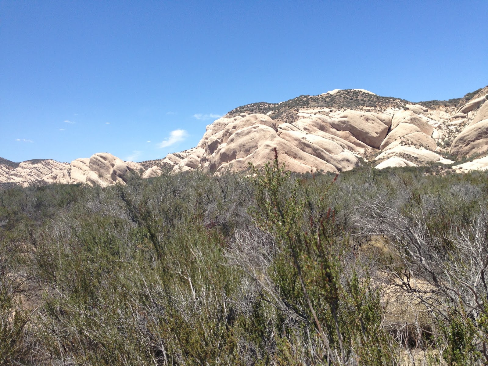
That said, on that side route I did see some rock formations I liked and experience a Joshua Tree forest which I’d never seen. I’ve seen individual Joshua trees but not a large forest of them. It was interesting but apparently not to the extent that I stopped to take a picture because I didn’t get one picture of them.

I was more concerned about the route Jill had me on – to the point that I ended up buying a paper map of California so that I could see where she was leading me. I’ve always had good luck with the GPS in the past but this was different. I ended up sitting in a traffic jam for 45 minutes or so on I-215. I really didn’t have a deadline to meet but I wanted to spend all of my dilly dallying in Oregon and Washington, not southern California which I could get to from Phoenix in a reasonable number of hours.


Highway 138 near Antelope Acres
Once I got through with the straight stretches of highway 138 and headed north on Interstate 5 from Gorman, I settled in to the boring part of the trip which I-5 is. The traffic was awful, too. The speed limit is 70 MPH along that stretch of I-5. I was lucky to get up to 70 for most of the drive. It was mainly about 65 MPH with cars almost bumper to bumper, weaving in and out. I had hoped to make it to a truck stop near Redding, California but around 10 PM I ended up pulling off at Williams, about 100 miles short.

I was getting drowsy and decided I didn’t want to get another cup of coffee and stay awake until 2 AM or something. That would have likely ruined the following day by causing me to sleep late. So I found a closed up Denny’s restaurant next to a Chevron station and pulled in the parking lot and parked.


My Explorer Bedroom
I got out and set up my sleeping quarters in the back of the exploder. As I was filling up my air mattress I saw a couple of cop cars across the street and the officers were likely watching me. They sat there a bit then drove off. I got my sleeping situation set and then closed the Exploder up and walked around the parking lot. I was looking to see if there was anything worth taking a picture of. I wasn’t far off the interstate and was hoping I might be able to shoot a long exposure of tail lights but it wasn’t a good place.
I turned around to go back to the Exploder and the cops had returned and this time one of the cars drove into the Denny’s parking lot. A female officer got out and approached me. She asked if I was okay. I told her I’d just driven from Phoenix and was stretching my legs and thinking about getting some sleep. I asked her if it would be okay to sleep there and she said that it would be fine. She also said that she had the night shift and that she’d drive by and check on me! What a nice outcome that was!

After she left I went over to the Chevron, got a banana and bottle of water in order to justify using their bathroom, and then headed back to the Exploder where I slept like a baby knowing the police were watching over me. My first day was in the books!

Click here for the next installment...

Thursday, August 20, 2015

My 2015 Vacation, Part 2 of 7

Drugs


I started staging everything for my trip a couple of days early. I figured out most of my clothing needs and shaving kit needs and packed what I could. One thing I had to take care of was getting all of my prescriptions in advance so that I had enough to last the 2 weeks.

I get my medical prescriptions through Walgreens. I contacted them about how to fill some prescriptions in advance and they told me to contact my insurance company who told me to contact my pharmacy. I love how things are getting simpler in life. My local Walgreens at 83rd Avenue and Lower Buckeye in Phoenix (yeah, a bit of a plug there) took care of everything, and even figured out a way to get me an advance on a prescription the insurance company wouldn’t allow. They were great and I appreciated their help. On the other hand, I hate taking the medications so if it hadn’t worked out I would likely have been just as happy!


Reservations


I had made my motel reservations for Port Angeles. In fact, I made them twice. I didn’t have the flyer from my friend Judi and the reunion committee so wasn’t aware they’d made arrangements with a motel for the reunion visitors. I looked online and decided I didn’t want to pay the almost $200 per night the Red Lion was charging so I looked around.

I ended up booking a motel room through Expedia which I’d never used. I let my friend Judi know about it and she reminded what motel that place was and how awful it is (Holiday Lodge, Port Angeles). She let me know of another inexpensive motel that another class mate uses repeatedly so I called them. They had a room available so I decided to take that and cancel the Expedia purchase. This was all on the same day (July 3rd) and Expedia charged me $40 or so to cancel the room. I won’t use them again. Yes, they did have warnings but they also had a notice that cancellations were free. Turns out they were $40 worth of "freeness".

Royal Victorian Motel, Port Angeles
I called the second place back to make my reservation, at the Royal Victorian. The woman at the desk was a very pleasant oriental gal and she was happy to chat for a bit. We made an initial arrangement and then she hesitatingly mentioned they had a cheaper room available. The catch was that it was smaller and didn’t have an air conditioner. I used to live in Port Angeles and had experience with their heat waves. I currently live in Phoenix, Arizona and have experience with the heat there. I asked her what the weather typically is like in Port Angeles and she said it gets into the 70s during the day and the 50s at night. I thought I’d be able to handle that without an air conditioner. She laughed and we changed my room to the one without the air conditioner.

The campgrounds on the Pacific coast of Washington did not take reservations. I called Bogachiel State Park and the ranger said they do fill up but they’re first come first serve.


Beachside State Park, Oregon
I also called a private campground I was interested in staying at in La Push, Washington, the Quileute Oceanside Resort. It had been many years since I’d been to La Push, over 40 years for sure. It looked like they had a great beach to take some pictures of at sunset and the gal at the resort said I didn’t need a reservation for the campsites. I decided I could take my chances because it’s only about 60 miles from that area to Port Angeles and I was sure that if nothing else I could just go to Port Angeles and get a motel room.


I made reservations at Beachside State Park and Cape Lookout State Park in Oregon, both of which offered showers and camping near the beach. The reservations were about $29 per night. I was set for most of my accommodations.


Cape Lookout State Park, Oregon
The only other night I needed to address was the first night on the coast but I wasn’t sure where that would be so I decided I would play it by ear, getting a motel room somewhere if necessary. As it turned out, I stayed in a motel, but more on that later.


Batteries


I also charged up all of my devices to have them ready to go. That included my Kindle, my RAVPower RP-WD01, my 4 camera batteries, my 4 Eneloop flash batteries, and my MP3 player. I ensured I had my power inverter and charger unit with me. I ensured all of my SD cards were formatted.

Final Packing


My Exploder Camping Quarters
I packed my new self inflating air mattress from REI, my sleeping bag, a blanket, and a pillow. I didn’t plan to cook while camping but took a cooler to store a few things in, a bin with a box of crackers, some Vanilla Wafers and breakfast bars and sugar free hard candy.

On Sunday, August 2nd, I had all of my stuff ready and eventually packed in the Exploder. I laid my one sport coat I was taking, a dress shirt, and slacks on top of everything and I was ready to go!

I said goodbye to my wife, my dogs, and I was off on my adventure!


Click here for the next installment...


Wednesday, August 19, 2015

My 2015 Vacation, Part 1 of 7

This blog, or likely series of blogs, is more of a personal note and not thoroughly related to photography although photography does play a part. I mentioned this trip in my previous blog, and I elaborate more here. I wanted to write about my travels, however, and this is the best place I have to do it...

My Reasons


I had three reasons to plan and take a trip in August of 2015. First, and the least significant, is that my birthday is at the beginning of the month and I usually try to take some time off. Not for any other reason than it is a selfish present to myself and for the last couple of years I drive somewhere and take some photographs. And, there aren't any other holidays in August so I wouldn't have any time off of work without this present.

This year, however, there were two additional reasons. Important reasons.

Selfie at Seal Rock, Oregon
This year marked my 40th high school graduation anniversary and reunion from Port Angeles Senior High School in Washington. I had never been to a high school reunion, in part because I'd never received the notice or invitation, in part because I never tried to find out about the reunions in previous years, and in part because I haven't had much connection to high school classmates.

I am not a big fan of Facebook, and have many questions about how it can truly be worth much on the stock exchange, why they do some of the software design things they do, etc., but I can't deny that I would not have established a communication channel with high school classmates without it. I have become Facebook friends with a number of classmates over the previous years and have really enjoyed communicating with them and sharing pictures. It has made me FEEL. I have felt comfort, kinship, familiarity, sadness, and joy, to list a few feelings, as I’ve read about their problems, successes, and experiences in the town I went to high school as well as the other towns or cities they live in currently.

This year was also the year things have worked out well for my son Ryan and as a result he announced he and his wonderful partner Kara were going to get married in August. He and Kara had been together for some years, living in Portland, Port Townsend, and now in Suquamish, Washington which is about 65 miles from Port Angeles. They discussed it with me and set the date so that it didn’t conflict with my high school reunion to ensure I could attend. The thought of that consideration and desire makes me tear up still. I feel so very lucky to have Ryan think that highly of me especially since he lived most of his childhood with his mother.

I requested the time off early in the year and in June and July I started making plans for the trip. I took the week off leading up to the reunion, which I attended events on Friday and Saturday, August 7th and 8th. Ryan and Kara were getting married the following Friday, August 14th. I took most of the week after the 14th off to give myself time to get back to Phoenix, work on some photography post processing, and to “ease” back into returning to work.

I planned to drive the trip, heading up as much of the Pacific coast as possible with the hopes of capturing some photographs, and arriving in Port Angeles on Friday the 7th. After the reunion I planned to go to Suquamish and spend a few days with Ryan and Kara before leaving for the wedding on Wednesday, August 12th. I planned to stay with my sister in law Linda but as it turned out, I stayed with my daughter Jessica in Newberg, Oregon, who needed some company. I hoped to also meet some other friends while in the Newberg area before returning to Phoenix. The Microsoft “bing” map website estimated the trip at about 3,400 miles, not counting any local driving I might do.

Elmer watching me prepare for the trip
To be honest, I had some worries when planning the trip. I felt old. I hadn’t been notably outside of Arizona for maybe 5 years, and hadn’t been away from home for that amount of time since moving to Phoenix in 2001. I certainly hadn’t planned an itinerary of that scale for years. I had questions about which route to take, where to stay, how far I could drive in a day while trying to take pictures. I had a big concern about not having my dog Elmer with me; Elmer always accompanies me on my weekend photography excursions.

For some time I have made some of my weekend trips by simply sleeping in the back of my Ford Explorer (Ryan calls it and “Exploder”). I often set out on trips planning to do just that but I find that as night draws close I end up looking for a camping ground and sometimes end up getting a motel room. I just don’t want to try to settle in somewhere and then either get woke up by traffic or other noise, or by a police officer who says I can’t sleep at that location. I know how I don’t feel very good the following day if I don’t get some good sleep. My eyes burn and I just feel miserable overall and it doesn’t end up being conducive to taking photographs.

I ended up deciding I’d spend the first night in northern California at a truck stop sleeping in the Exploder but after that I’d be at the coast for 4 nights. I made campground reservations for 2 of the nights. I figured I’d deal with the first night at the coast when I got there, and for the last night at the coast the place I called said I didn’t need a reservation (more on that later). Then I’d be in Port Angeles and for that I made motel reservations for 2 nights. The rest of the trip would be spent with family. Once I had my itinerary nailed down to that level I was pretty relaxed and excited to start, other than making the trip sans Elmer.

Almost an entire week at the beginning of the trip would allow me to shoot some photographs along the Oregon and Washington coast. That also caused me to be concerned with preparations for the camera gear. But it wasn’t until the week before leaving that I realized I needed to do a few things related to my photography equipment.

First, I’ve gone out on weekends and shot perhaps 500 exposures in one day. This gave me anxiety over storage for images. I have a few SD cards for the two cameras (Nikon D610 and Nikon D3200) but if I ended up shooting a lot I would exceed my SD card capacity. I decided to get a 1T Seagate USB hard drive. I have a RAVPower RP-WD01 SD Card Reader, WiFi hub, and USB port which allows me to transfer data from an SD card to a USB device. I ordered the drive from Amazon and tried out my plan and had that problem solved.

Note that the RAVPower device is about the same size as the USB drive. I can use software on either my Kindle or iPhone 5 to manage the data transfer.

I really wanted to do this instead of buying additional SD cards because I really don’t want to manage a lot of SD cards. By offloading to the USB drive I can store a terabyte of data. And, with the price of USB drives, it ends up being cheaper as well. Plus, although I didn’t do it for this trip, you could take 2 USB drives and copy the files from the SD card to both drives (one at a time) and have a backup copy.

This plan allows me to use enough SD card space for a single day and then offload them to the USB drive(s). Not long before my trip I purchased a 16G SanDisk ExtremePro card with a 95MB per second write speed to use for burst shots. I like it, and think I’ll get another one. Thom Hogan recommends staying at the 32G or lower cards because the cameras seem to read and write slower with the bigger cards. I’ve experienced the same thing so I got this very fast card in only the 16G size and it works amazing.

My main cards before this have been Lexar 600x 32G cards which have a 45MB per second write speed. I use 2 of them in the Nikon D610 camera and they are very stable, giving me over 500 shots per card. I use a single SanDisk Ultra 16G card with a maximum 30MB per second write speed in the Nikon D3200 and I get about 250 shots on that card. I have some additional cards as well but I think I’ll switch over to the 16G SanDisk ExtremePro 95MB speed cards for my main cards, meaning I need to purchase 2 more of them.

One other purchase I made before my trip was a UV filter for my wide angle lens. I read from many sources that it’s a good idea to use one for protection when you’re at the coast to protect the lens from blowing sand and salt water spray. I have not been one to use a ultra-violet (UV) filter for protection purposes in the past. I fall more in the Thom Hogan (and others ) camp that feels it’s not really necessary and it adds another piece of glass in the light transmission path that can reduce image quality (IQ). Most people in this camp feel that a lens hood does more to protect a lens and DSLR cameras are not susceptible to UV light anyway (unlike film cameras of the past).

However, one place everyone seems to agree that a UV lens is worth it is at the beach. So I picked up a B+W 77mm UV MRC lens for the Nikkor 16-35mm f/4 lens. It’s a $1,260 or so lens and using a $55 UV filter to avoid ruining it seemed financially sound even if I never use it afterwards. I already had a B+W 52mm UV MRC for the Nikkor 50mm f/1.8 lens and I had a cheap 67mm UV filter for the Nikkor 70-200mm f/4 lens which I just planned to use only when necessary.

One other note I’ll make about camera gear is that I did try to take a few pictures during the trip with the 70-200mm lens that I really wanted longer exposures for and didn’t have enough neutral density filtering available. It sucks when you’re somewhere and you want to take a shot that you may never get to again and you don’t have the filter you need. In my case it was before the sun went all the way down, and I wanted to blur the wave action on a beach. I couldn’t do it without blowing out the picture. After not being to the coast in at least 14 years and then not being able to take the shot I wanted when I was there was disappointing to say the least.

That was all the “real” photo gear I added prior to my trip. However, one thing I also did was add a iPhone 5 to my luggage. I haven’t been using a cell phone since the early 2000’s. My wife wanted the new iPhone 6 Plus so we got that and I took over the iPhone 5, mainly so that I could use it to arrange or find lodging along the trip. What I didn’t expect was the extent I used it for photographs.

By the time I got home from the trip I had racked up 3,849.2 miles, 1,344 pictures on the Nikon cameras, and 1,699 pictures and videos (a dozen or so videos) on the iPhone. I found that most of the pictures during the day were not going to be great no matter what camera I used so I ended up taking more of what I consider “snapshots” with the iPhone than getting out the Nikons. When I wanted to try to get the best image quality, mainly golden hour or night shots, I used the Nikons.

Downtown Portland (iPhone 5)
I also found I used the iPhone to take pictures that I could immediately share on Facebook, letting my classmates and family and other friends see what I was up to. I got a lot of, well, “mention” from classmates about the frequent “where’s Waldo” updates. Most of them had fun with it, I think, and I know I did. Thanks again, Facebook.


Click here for the next installment...