 |
| Gassed up and ready to go! |
I had debated on the route to take to get to Oregon due to a bridge being washed out on Interstate 10 a bit west of the Arizona – California border. I contemplated going through Las Vegas, and even visiting Yosemite. But then I read about how busy it was during the summer months and got dissuaded.
In the end it still seemed like the shortest route would be on I-10 so that’s the direction I headed. I had decided that it made more sense for me to get to Oregon as soon as possible. I could drive to Yosemite on a 3 day weekend, or at least a 4 day trip. I couldn’t get to Oregon or Washington and back that fast.
 |
| Washed out east-bound bridge on Interstate 10 |
As I got close to Los Angeles my GPS started directing my route as well as my adventures. I have been through Los Angeles many times; I lived in San Diego and Long Beach for about 4 years and drove to the Portland, Oregon area many times.
Normally when I drive between Phoenix and Oregon I take the Interstate 210 through Pasadena, saving a few miles and some time. My GPS, whom I refer to as “Jill” because that is the name of the voice that I use for the directions and notifications, had started me on I-210 but then directed me to I-215 and eventually highways 138 and 18 through Phelan, Littlerock, Palmdale, Lancaster, and eventually Gorman where I merged on to Interstate 5. I’m not saying it was unpleasant and that I didn’t appreciate her taking me on such a circuitous route, but it probably added an hour of driving time. I did NOT end up retracing the route on my return trip.
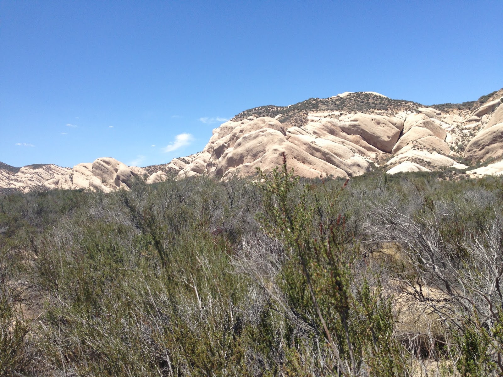 |
| Rocks north west of Cajon Junction |
I was more concerned about the route Jill had me on – to the point that I ended up buying a paper map of California so that I could see where she was leading me. I’ve always had good luck with the GPS in the past but this was different. I ended up sitting in a traffic jam for 45 minutes or so on I-215. I really didn’t have a deadline to meet but I wanted to spend all of my dilly dallying in Oregon and Washington, not southern California which I could get to from Phoenix in a reasonable number of hours.
 |
| Highway 138 near Antelope Acres |
I was getting drowsy and decided I didn’t want to get another cup of coffee and stay awake until 2 AM or something. That would have likely ruined the following day by causing me to sleep late. So I found a closed up Denny’s restaurant next to a Chevron station and pulled in the parking lot and parked.
 |
| My Explorer Bedroom |
I turned around to go back to the Exploder and the cops had returned and this time one of the cars drove into the Denny’s parking lot. A female officer got out and approached me. She asked if I was okay. I told her I’d just driven from Phoenix and was stretching my legs and thinking about getting some sleep. I asked her if it would be okay to sleep there and she said that it would be fine. She also said that she had the night shift and that she’d drive by and check on me! What a nice outcome that was!
After she left I went over to the Chevron, got a banana and bottle of water in order to justify using their bathroom, and then headed back to the Exploder where I slept like a baby knowing the police were watching over me. My first day was in the books!
Click here for the next installment...
No comments:
Post a Comment