Showing posts with label gps. Show all posts

Saturday, August 29, 2015

My 2015 Vacation, Part 6 of 7

I woke up sometime around 5:30 AM on 8/5/2015, as the sun was making itself known. I had slept really well in the back of the Exploder, and really was happy with the REI self inflating sleeping pad. I had zero complaints about my sleeping arrangements, unlike when I previously used simple foam pads. I got up, walked to the bathroom, returned and re-arranged the inside of the Exploder, had a breakfast bar, and started my day.

I had reserved a campsite for the day at Cape Lookout State Park, about 81 miles north. According to Google it’s about a 2 hour drive and I had the entire day to do it. Cool! That should leave some time for taking some pictures.

Path to the Pacific at Beachside State Recreation Site
I started by snapping a few iPhone pictures of my campsite at Beachside State Recreation Site with the iPhone. My site was maybe 50 yards from a beach access path, which opened almost directly on to the Pacific and its constant and reassuring gentle roar of the surf. I took the pics but didn’t actually walk on to the sand. As much as I like being at the coast I really am not a big fan of being on the sandy beaches or dunes.

I fired up the Exploder and headed her north along the Oregon Coast Highway (Highway 101) with the sky starting to lighten.

As I came to the Alsea River and crossed the Alsea Bay Bridge at Waldport, the sun was beginning to show above the horizon. I noticed that there was a jetty to the west of the bridge and it occurred to me that there could be a shot of the sun coming up over the bridge just waiting for some tourist that took the time to drive over there.

I looked at Jill the GPS and tried to figure out how to get over there. On my second attempt, after hitting a dead end, I was cruising through the Bayshore area. There are a lot of houses there and pretty much the entire eastern waterfront is private property except for one vacant lot. I drove onto the lot, grabbed my Nikon D610, 50mm lens, and Manfrotto tripod and scurried to the edge of the water.


Alsea Bay Bridge at Waldport
I got set up as the sun was already up over the bridge and realized I couldn’t frame the entire bridge with the 50mm. I didn’t have time to go back and get the wide angle lens, though, so I shot with what I had. I like the results but wish I’d had the wide angle lens. I would really like to go back and try that shot again using the wider lens. Thank you to the residents for leaving the vacant lot, and thank you to the powers that be for a nice image to start my day!

I headed on up the road, until stopping off at Seal Rock State Wayside again. Actually, I stopped at the pull off at Little Creek, just south of NW Cross Street. I got out the Nikon again and took a lot of pictures of the waves hitting the rocks there. I really wanted some sort of wave action and this was about as good as I was going to get in the middle of summer.

I continued up to Newport where I paid another visit to the McDonalds for breakfast and coffee. I took advantage of their free WiFi and uploaded some posts to Facebook, called my wife, and brushed my teeth in the parking lot. Okay, I didn’t need WiFi to brush my teeth.


Yaquina Head Lighthouse
I drove up to Yaquina Head Lighthouse, arriving there about 8:00 AM. I was too late for the golden hour but the sun was still fairly low on the horizon and providing some nice side light. I got some pictures of the lighthouse, the seals on the rocks at Yaquina Head Marine Garden from up above (you can walk down to the rocks), and from the north side of Yaquina Head. I saw some whales spouting but couldn’t really get a picture of them. What a glorious morning it was there! I could easily have taken a position as a lighthouse keeper there!

I did think to myself that I could have used a longer lens while shooting the seals on the rocks. If I’d gone down the path it would certainly have got me closer but I would have lost the perspective of the shot from above. I have a personal philosophy that I don’t buy things just because I think they’d be nice to have, but if they’re somewhat expensive at all and I’m skeptical at all about how much I’d use them I wait until I think I could have actually used the item at least twice before I spend the bucks. This makes occurrence number one for a longer lens (like the Sigma 150 to 600).

After some amount of time at Yaquina Head, I continued on my way north. I drove past Beverly Beach State Park and recognized it as the last place I went camping for many years. My first wife and I camped there in the late 1970’s on our Honda Goldwing. We woke up to rain. The tent and sleeping bags were soaked. We had to crawl out of the small tent (the Goldwing didn’t allow us to take a huge tent) into mud. We had to drive about 120 miles from there to our home in Portland in the rain, soaked and muddy. I didn’t camp again after that until the late 1990’s when my third wife and I started fishing and camping at Detroit Lake in Oregon.

Looking south from Otter Crest Wayside
I made my next stop at Otter Crest State Wayside and the Cape Foul Weather gift shop at about 10:30AM. This is a cute little gift shop perched on the side of a cliff at about 450 feet above sea level. People inside were taking advantage of the whale viewing. I picked up some souvenirs for my wife, a few co-workers, and myself. I took some pics with the iPhone and settled for them without getting a Nikon out. 

After bit more driving I got to Depoe Bay, Oregon at about 11:00 AM. I have always enjoyed Depoe Bay; it resonates with me for some reason. It’s probably my favorite town on the Oregon coast. This was the first time, however, that I actually drove much off of the main highway. With Jill’s guidance I drove to the east side of the bay, past the Coast Guard station, and found a place to park near the marina. I got out and walked around, taking some iPhone pictures of the activity there – people returning from their morning charters were having their fish cleaned. It was a very busy area, people going to and fro, children playing, the smell of the ocean and fish being cleaned, perhaps even some fish tales being told! If I could have a job there I’d have stayed without any hesitation. It made me think of my son and his commercial fishing. I wonder what people must have thought when they saw me walking around with a grin on my face!?

The bridge and marina at Depoe Bay
From there I decided to stop at Boiler Bay State Scenic Viewpoint. I did try some pics with the Nikon there, wanting them to be interesting, but my wanting didn’t make it so. By now the sun was pretty much overhead at about noon, and there really wasn’t much to take a picture of besides the rocks themselves. The best subject were some people fishing on the rocks but even that didn’t seem great. This place is nice when there are heavy swells crashing, mainly in winter, but on the day I was there it was a pleasant summer day, nice in its own right, just not for photographs.

I headed back to Depoe Bay to grab some food at the Sea Hag Restaurant. It’s a place I’ve gone to for years and I’ll always remember taking my kids there. I think the last time we went there we got a bucket of oysters. I just had a wonderful, fresh, cod fish and chips, with a bowl of clam chowder. Yum. Then I got a bag of salt water taffy for my wife before taking some more iPhone pictures and heading north again.


Looking north at Netarts Spit
I travelled through Lincoln City where I fueled up, past the intersection with Highway 18 which leads to Portland through McMinnville and Newberg, where I’d be in a week or so. I continued to Neskowin and then exited Highway 101 onto Brooten Road, passing through Pacific City, and following the road until taking a left on Cape Lookout Road.

I stopped at the pull out that overlooks the Netarts Spit, the base of which is where Cape Lookout State Park campground is located. The overlook is about 325 feet above sea level and gives a nice view of the spit from the south. I tooks some pictures with the iPhone - had to post to Facebook to make everyone that I knew on Facebook who wasn't there with me a bit jealous. Especially the Arizona folks. The Oregonians could get there in a few hours.

I continued on down the hill to the campground and checked in. It was late afternoon and I decided I would put up the tent this time but I wanted to do it before it was dark. I got the camp set up about 5:00 PM and then decided to head on up to Oceanside and Cape Mears.

Cape Mears Lighthouse
There is a small lighthouse at Cape Mears. It's a short walk from the parking lot, perhaps 1/4 of a mile. Note that it is downhill from the parking lot. Going back is a bit more of a chore. There are two paths from the parking lot and both of them have benches along the path so that you can stop and rest on the way up, or stop and enjoy the scenery. This light house is tough to get a good picture of due to the small size of the grounds where it is located and the likelihood of other visitors that will be in the picture.

From there I decided to find something for dinner. I went in to Oceanside but the only thing I could find was a good sized diner and I wasn't really interested in a big meal. I just wanted a cheap gas station sandwich but there aren't any gas stations in Oceanside. I punched "grocery store" in to Jill the GPS and she claimed to find one. When I got there it was an old, closed up building. The next nearest store was in Tillamook so off I went.

I got to Safeway but instead of getting a cold sandwich I bought a couple of pieces of their hot deli chicken and some potato wedges. I already had my own water. I ate in the Exploder while posting some things in the Safeway parking lot. There hadn't been any cell phone reception out on the beach. I watched a cute girl in a car with California plates pull up in front of me and sit a few minutes before a guy pulled up in a car with Oregon plates. She got in his car and they drove off.

When I was done I headed back to Oceanside and located a public parking lot with beach access. I chatted a while with a guy driving a motorcycle who was sitting on a fence playing his acoustic guitar he'd brought with him. He was from a bit of a distance (I think he said he was from Salem) and had gone out for a quick ride but ended up at Oceanside.

Oceanside, Oregon

Oceanside is a cute little town situated mainly on a hillside facing southwest overlooking the Pacific. What a pretty place to live if you can. Even visiting was nice. But the coolest thing are the Three Arch Rocks National Wildlife Refuge just off shore from Oceanside. In the summer months the sunset can be lined up between the rocks making for a great sunset photo.

I took the D610 and tripod down to the actual sand. The wind was blowing a bit but not kicking up sand. I got some very nice pictures there with both the Nikon and the iPhone. There were kids on the beach flying kites and I was worried at first that they'd ruin the shot but when I was composing through the viewfinder I found I actually preferred the shot when they were in it. I got plenty of both!

Three Arch Rocks National Wildlife Refuge


After the sun disappeared I made my way back up the beach to the Exploder and then back to my campsite. I got there in near dark. I decided to pour a few ounces of Johnny Walker, reviewed the pics on my cell phone and Nikon as I had a drink, then went to bed and again slept like a babe!

Click here for the next installment...

Friday, August 21, 2015

My 2015 Vacation, Part 3 of 7

Gassed up and ready to go!
On Sunday, August 2nd, I headed out at about 9:30 AM. I stopped at the local Fry’s Grocery store to get some pre-made sub sandwiches, a couple of gallons of drinking water, and to fill up the Exploder’s belly with unleaded. I took a selfie and then I was off!

I had debated on the route to take to get to Oregon due to a bridge being washed out on Interstate 10 a bit west of the Arizona – California border. I contemplated going through Las Vegas, and even visiting Yosemite. But then I read about how busy it was during the summer months and got dissuaded.

In the end it still seemed like the shortest route would be on I-10 so that’s the direction I headed. I had decided that it made more sense for me to get to Oregon as soon as possible. I could drive to Yosemite on a 3 day weekend, or at least a 4 day trip. I couldn’t get to Oregon or Washington and back that fast.

 
Washed out east-bound bridge on Interstate 10
The washed out bridge turned out to be a non-issue. Traffic had to slow down a bit for a mile or so but in the scope of the entire distance between Phoenix to Los Angeles, it was nothing. It may have added 5 minutes to the trip. It was also my first attempt at taking iPhone pictures while driving - they didn't turn out very good. I didn't know how to force the phone to focus. I know that this practice is probably frowned upon and I shouldn’t do it but I was careful not to keep my eyes off of the road. That’s the last I’ll say about that – I don’t promote the idea of doing this and I’m a hypocrite.

As I got close to Los Angeles my GPS started directing my route as well as my adventures. I have been through Los Angeles many times; I lived in San Diego and Long Beach for about 4 years and drove to the Portland, Oregon area many times.

Normally when I drive between Phoenix and Oregon I take the Interstate 210 through Pasadena, saving a few miles and some time. My GPS, whom I refer to as “Jill” because that is the name of the voice that I use for the directions and notifications, had started me on I-210 but then directed me to I-215 and eventually highways 138 and 18 through Phelan, Littlerock, Palmdale, Lancaster, and eventually Gorman where I merged on to Interstate 5. I’m not saying it was unpleasant and that I didn’t appreciate her taking me on such a circuitous route, but it probably added an hour of driving time. I did NOT end up retracing the route on my return trip.

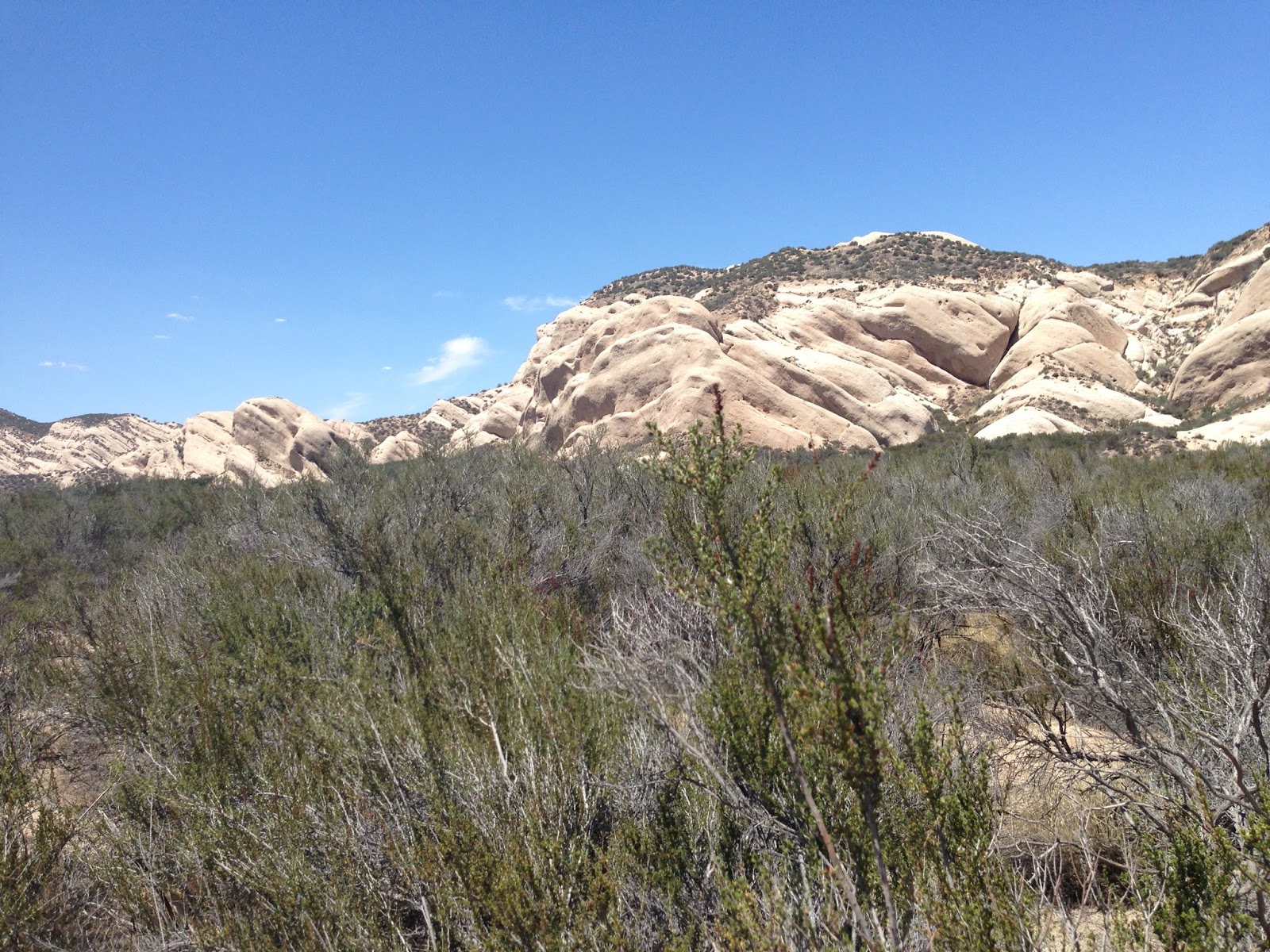
Rocks north west of Cajon Junction
That said, on that side route I did see some rock formations I liked and experience a Joshua Tree forest which I’d never seen. I’ve seen individual Joshua trees but not a large forest of them. It was interesting but apparently not to the extent that I stopped to take a picture because I didn’t get one picture of them.

I was more concerned about the route Jill had me on – to the point that I ended up buying a paper map of California so that I could see where she was leading me. I’ve always had good luck with the GPS in the past but this was different. I ended up sitting in a traffic jam for 45 minutes or so on I-215. I really didn’t have a deadline to meet but I wanted to spend all of my dilly dallying in Oregon and Washington, not southern California which I could get to from Phoenix in a reasonable number of hours.


Highway 138 near Antelope Acres
Once I got through with the straight stretches of highway 138 and headed north on Interstate 5 from Gorman, I settled in to the boring part of the trip which I-5 is. The traffic was awful, too. The speed limit is 70 MPH along that stretch of I-5. I was lucky to get up to 70 for most of the drive. It was mainly about 65 MPH with cars almost bumper to bumper, weaving in and out. I had hoped to make it to a truck stop near Redding, California but around 10 PM I ended up pulling off at Williams, about 100 miles short.

I was getting drowsy and decided I didn’t want to get another cup of coffee and stay awake until 2 AM or something. That would have likely ruined the following day by causing me to sleep late. So I found a closed up Denny’s restaurant next to a Chevron station and pulled in the parking lot and parked.


My Explorer Bedroom
I got out and set up my sleeping quarters in the back of the exploder. As I was filling up my air mattress I saw a couple of cop cars across the street and the officers were likely watching me. They sat there a bit then drove off. I got my sleeping situation set and then closed the Exploder up and walked around the parking lot. I was looking to see if there was anything worth taking a picture of. I wasn’t far off the interstate and was hoping I might be able to shoot a long exposure of tail lights but it wasn’t a good place.
I turned around to go back to the Exploder and the cops had returned and this time one of the cars drove into the Denny’s parking lot. A female officer got out and approached me. She asked if I was okay. I told her I’d just driven from Phoenix and was stretching my legs and thinking about getting some sleep. I asked her if it would be okay to sleep there and she said that it would be fine. She also said that she had the night shift and that she’d drive by and check on me! What a nice outcome that was!

After she left I went over to the Chevron, got a banana and bottle of water in order to justify using their bathroom, and then headed back to the Exploder where I slept like a baby knowing the police were watching over me. My first day was in the books!

Click here for the next installment...